Upcoming Event Tech Maven Geospatial Speack at GEOINT SYMPOSIUM in St Louis Missouri

Geo Data Collector 1.0 iOS has launched!

https://apps.apple.com/app/geo-data-collector/id1612014577

Geo Data Collector iOS has officially launched on July 27, 2022!

We’ve been working extremely hard on this app for several years

https://geodatacollector.techmaven.net/

We’ve got a big ambitious roadmap and we know field workers/surveyors will love this app

It really streamlines workflows and makes it easy to collect data and share collected data


Apps November 2021

Apps November 2021

We are excited to be launching in November 2021

  • Map Discovery Advanced Mapping App 1.0 iOS and Android
  • Portable Tile Server Android 1.1 with vector tiles to raster tiles dynamic conversion and ATAK/WINTAK/ITAK XML Endpoint
  • Print Map 1.1 with new features like draw and user geojson and about 20 new map styles
  • Map Explorer 1.0 with catalog data loading and support for digitizing/drawing and loading GeoJSON


Special Promotional Period for Mobile Apps

Special Promotional Period for Mobile Apps

Tech Maven Geospatial has decided to offer our apps for free for a few months to solicit feedback, get reviews and ratings and build a good community around our products.

We are NOT advertising or selling data or performing any tracking

The next versions of our apps will include free trial and then in-app purchase to unlock the app and also in-app purchases for unlocking additional capabilities and data

We are kindly asking that you please take the opportunity to leave a review and send your comments/suggestions/feedback to feedback at techmaven.net

Announcing Release of GeoNames Map Explorer 1.0.0 iOS NGA’s GEOINT App Store

Announcing Release of GeoNames Map Explorer 1.0.0 iOS NGA’s GEOINT App Store

GeoNames Map Explorer – *Version 1.0.0* launched on NGA’s GEOINT APP STORE

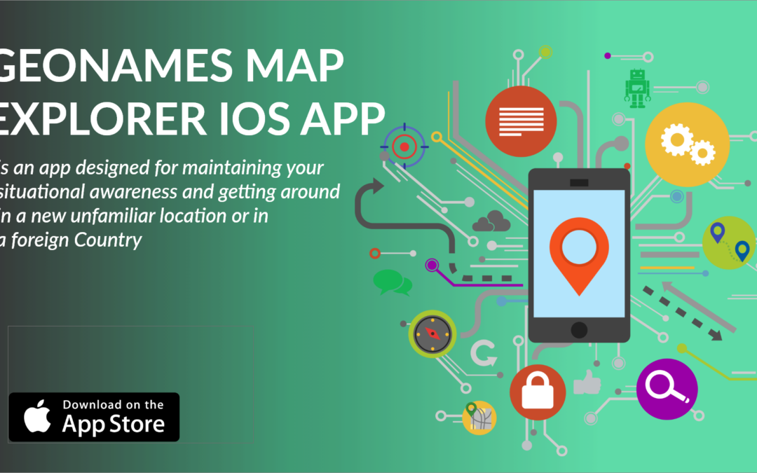
GeoNames Map Explorer App is an app designed for maintaining your situational awareness and getting around in a foreign country. It has NGA’s Foreign GeoNames & USGS Domestic GeoNames databases setup in highly optimized fashion for display on map, table/grid and searching.

The app supports Audio Playback Pronunciations with advanced map with navigation and bearing and distance calculations.
 

App Features & Capabilities

  • The app works immediately after install with internet access
  • The map, search and audio playback work with data on Tech Maven Geospatial’s server
  • Offline Data can be downloaded for custom user defined area of interests
  • Required data is automatically requested and optional data can be selected and downloaded
  • Users can also load their own map data (GeoJSON and MBTILES and GPKG raster tiles 3857)
  • Users can load their own PDF documents
  • The app has an advanced mapping engine that’s vector tile based with OpenMapTiles OpenStreetMap Vector Tiles with custom stylesheets as well as raster tile basemaps
  • GeoNames data is displayed by Feature Class and users can decide what feature classes to show. The GeoNames Display field is used to control the scaling/zoom levels of the data.
  • Advanced GeoNames Search and Spatial Search (constrain your queries to a certain geographic area)
  • Supports GeoPackages


The Map Features :

  • Coordinate Display (Lat Long, MGRS, GARS)
  • Scale Bar
  • Measure Area and Linear Tools
  • GeoLocation with settings for tracking your location
  • Spatial bookmarks

Online Layers Raster Tile Basemaps Picker

Raster Tile Basemap

Time Zones Vector Overlay

Measure Area Map

Select Your Area (AOI)

Bookmark

Manage AOI Request

Change OSM Style

MGRS Grid

Attribute Table Search

The map has optional vector tile overlays that can toggled on MGRS Grid, GARS GRID, TimeZones, International Boundaries The map supports searching MapBox and OSM
 

Announcing Release of New Version GEOINT DATA EXPLORER 1.0.0 iOS NGA’s GEOINT App Store

Announcing Release of New Version GEOINT DATA EXPLORER 1.0.0 iOS NGA’s GEOINT App Store

GEOINT DATA EXPLORER – *Version 1.0.0* launched on NGA’s GEOINT APP STORE

GEOINT DATA EXPLORER is a rapid data visualization and discovery mapping app that works equally well offline into disconnected limited availability environments (D-DIL) as well as when partially or fully connecting to online mapping services, tile layers and catalogs. The Map has powerful data management and built-in tools for analysis and display of geospatial data.

GEOINT Data Explorer is meant to be a mobile GEOINT Toolkit that facilitates GIS Data Visualization, Discovery, Mapping,Data Creation and Editing and Analysis App that works 2D and 3D!
 
Fast performance, easily control the display of your data and mashup local and internet data, perform rapid analysis, data creation, editing, and visualization.

App Features & Capabilities

  • Spatial Analysis
  • Map controls
  • Bookmarks
  • Add point, line, polygon features
  • Paint

Supported Formats:

  • GeoPackage Raster Tiles
  • GeoPackage Vector features
  • MBTiles Raster tiles
  • MBTiles Vector tiles
  • MBTiles Elevation tiles
  • GeoJSON
  • KML
  • Shapefile
  • CSV point data
  • GeoTagged Photos
  • OpenStreetMap Basemap tiles with style picker and optional Contour and Hillshade

Shapefile

Vector Tiles MBTiles

Raster Tiles MBTiles

SPOT Elevation and Terrain Profile Views

OSM Vector Tiles 

Configure Mouse Over & Labels

The app can be used for Mission Planning and pre-flight planning. Review airspaces, Elevation information and other datasets like AVDAFIF or AeroApp mbtiles.

error: Content is protected !!