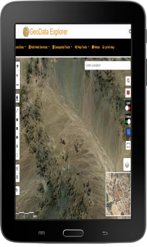
Geo Data Explorer – version 1.0.0 launched on Google Play Store for Android Tablets.
http://geodataexplorer.world
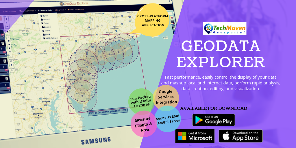
Geo Data Explorer is an innovative GIS mapping app and enables rapid data visualization, data collection, editing and analysis of internet map data and web services and local offline data. It’s designed for professional mapping use and has premium features and advanced capabilities.
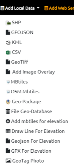
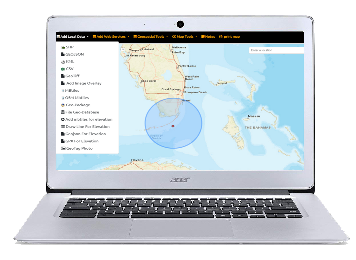
Add Data offline:
Wide list of Supported formats all displayed in a table of contents with access to attribute table, search, zoom to extent, opacity/transparency slider
- ESRI Shapefile (SHP) Zipped
- ESRI File Geodatabase Zipped
- GeoJSON
- KML/KMZ
- GPX
- CSV – Comma Separated Values Text File with Columns with Latitude and Longitude
- Geotiff Raster Imagery – limited support 10-15mb max size Geographic WGS84 (4326)
- Add image overlay (Scanned Image or Photo – rubber sheet it)
- Raster Tiles (PNG, JPG, WebP) from Mbtiles and GeoPackage SQLite
- Vector Tiles Mbtiles
- Vector Tiles Open Street Map MBTILES from OpenMapTiles.com with stylesheets integrated)
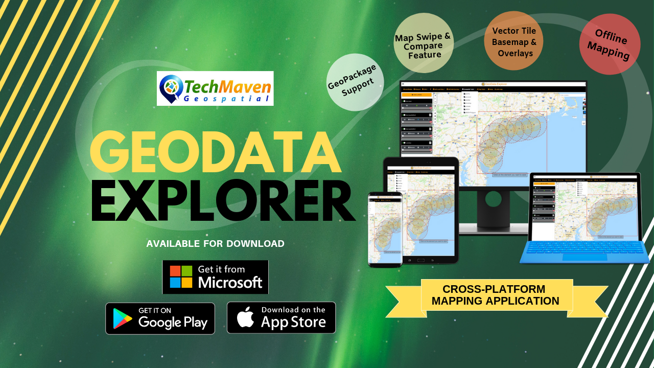
- OGC GPKG – Geopackage vector features
- Elevation Tiles (Terrarium PNG format)
Notes:Vector Data must be in EPSG:4326 Geographic WGS84 Coordinate System
Raster Tiles and Vector Tiles must be in EPSG:3857 Google Spherical Web Mercator
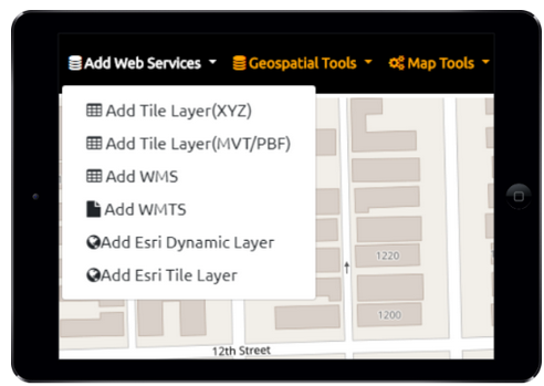
Web services support:
Add web services published from OGC Map Servers like GeoServer, MapServer, MapGuide and ESRI ArcGIS. Supported formats are
- TMS/XYZ TILE SERVERS (Raster and Vector)
- OGC WMTS – Web Map Tile Service
- OGC WMS – Web Map Service
- ESRI ArcGIS dynamic map services (MapServer)
- ESRI ArcGIS Feature Service (FeatureServer)
- ESRI ArcGIS ImageServices (ImageServer)
Online Basemaps
Default basemap is Open Street Map Vector Tiles with multiple stylesheets to choose from. We are self hosting OpenMapTiles.com data on our servers.
Online Basemap Picker with ESRI, Microsoft BING, Google, HERE, Stamen, Thunderforest, OpenStreetMap, CartoDB and many others.
Internet Weather overlays from OpenWeatherMap.com
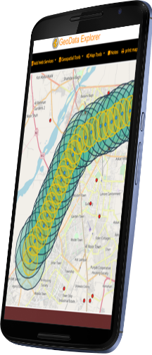
SPLIT/SWIPE to compare feature
View Attributes, Filter and Sort, Copy, Export attributes into many formats
Google Search, Google Places Integration
GIS Data Editing
Support editing and creating
- Polyline
- Polygon
- Rectangle
- Circle
- Point
Add Unlimited Feature Properties to collected data. Text based free form data entry.
Download Draw Layer as GeoJSON and perform analysis on draw layer
Configure feature Labels and Mouse/Position Over Labels (non permanent)
Table of Contents
Manage display of data
Control Opacity/Transparency of each item
Style editor:
Edit style of overlayer feature
- Change Outline color
- Change fill color
- Set border opacity
- Set fill opacity
- Change border style
Analysis tools:
- Layer to Buffer
- Voronoi
- Calculate Center
- Envelop
- Convex
- Layer to Bbox string
- Layer to Bbox polygon
MapTools
- Mini Map Overview
- Compass
- Paint and Annotation
- Scale bar
- Spatial BookMark
- Coordinates capture
- UTM
- GPS
- UTM
- UTM REF/MGRS USNG
- QTH
- NAC
- What3Words
- Geolocation
- GRIDS/Graticule Lines -Lat Long, MGRS, Distance Grids and others
- Measure Linear Distance and Area
Spot Elevation (elevation of one location and updates as you move) – supports mbtiles with MapZen Terrarium PNG Terrain Tiles.
Terrain Profile View Graph (draw line or from GPX)
Printing
Design and print you map
Notes:
Take and save notes about your analysis/ map
JSON Catalog for Web Services Data – this configures the Add Layers button in Table of Contents.
Supports IP GeoLocation and Internal Sensors (GNSS/GPS) as well as ability to connect to high precision external GNSS/GPS Receivers
Ability to Snap to Location
View GeoTagged Photos
Toggle Online/Offline Mode
Enable Full Screen to hide Menu and some tools