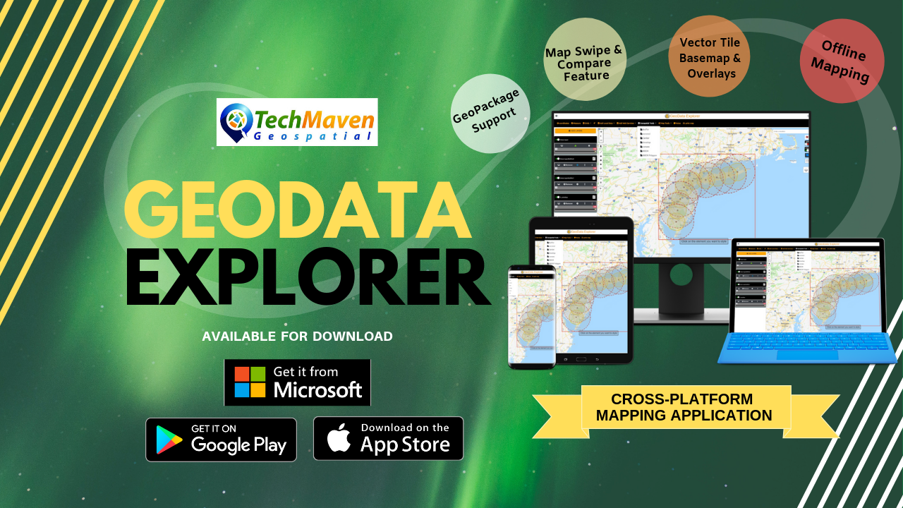
GeoData Explorer App – Android Released
Geo Data Explorer – version 1.0.0 launched on Google Play Store for Android Tablets.
http://geodataexplorer.world
Geo Data Explorer is an innovative GIS mapping app and enables rapid data visualization, data collection, editing
Add Data offline:
Wide list of Supported formats all displayed in a table of contents with access to attribute table, search, zoom to
- ESRI Shapefile (SHP) Zipped
- ESRI File Geodatabase Zipped
- GeoJSON
- KML/KMZ
- GPX
- CSV – Comma Separated Values Text File with Columns with Latitude and Longitude
- Geotiff Raster Imagery – limited support 10-15mb max size Geographic WGS84 (4326)
- Add image overlay (Scanned Image or Photo – rubber sheet it)
- Raster Tiles (PNG, JPG, WebP) from Mbtiles and GeoPackage SQLite
- Vector Tiles Mbtiles
- Vector Tiles Open Street Map MBTILES from OpenMapTiles.com with stylesheets integrated)
- OGC GPKG – Geopackage vector features
- Elevation Tiles (Terrarium PNG format)
Notes
Raster Tiles and Vector Tiles must be in EPSG:3857 Google Spherical Web Mercator
Web services support:
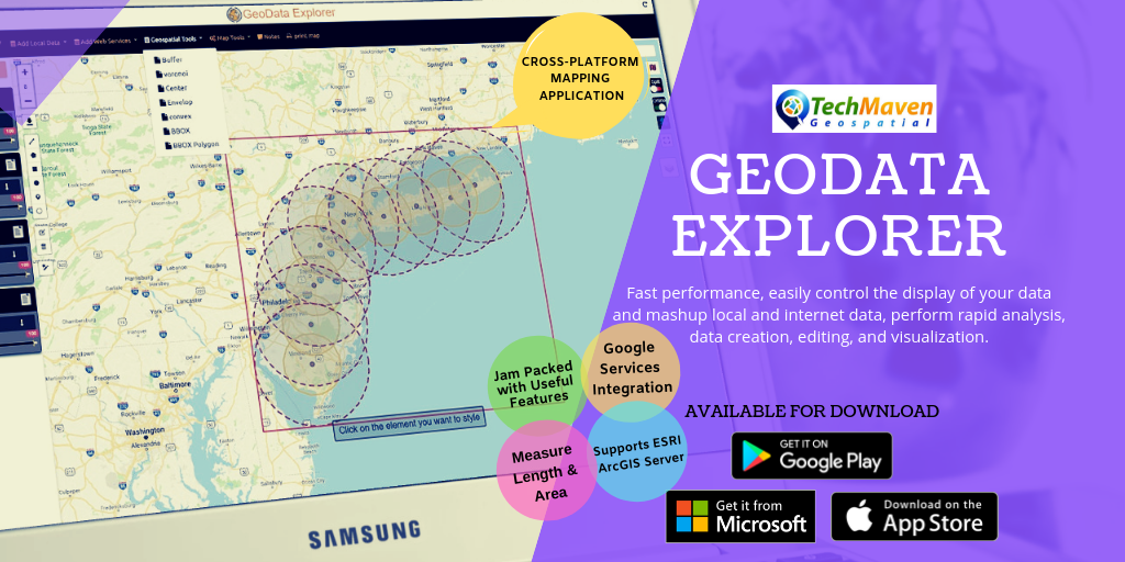
Add web services published from OGC Map Servers like GeoServer, MapServer, MapGuide and ESRI ArcGIS. Supported formats are
- TMS/XYZ TILE SERVERS (Raster and Vector)
- OGC WMTS – Web Map Tile Service
- OGC WMS – Web Map Service
- ESRI ArcGIS dynamic map services (MapServer)
- ESRI ArcGIS Feature Service (FeatureServer)
- ESRI ArcGIS ImageServices (ImageServer)
Online Basemaps
Default
Online Basemap Picker with ESRI, Microsoft
Internet Weather overlays from OpenWeatherMap.com
SPLIT/SWIPE to compare feature
View Attributes, Filter and Sort, Copy, Export attributes into many formats
Google Search, Google Places Integration
GIS Data Editing
Support editing and creating
- Polyline
- Polygon
- Rectangle
- Circle
- Point
Add Unlimited Feature Properties to collected data.
Download Draw Layer as GeoJSON and perform analysis on draw layer
Configure feature Labels and Mouse/Position Over Labels (
Table of Contents
Manage
Control Opacity/Transparency of each item
Style editor:
Edit style of overlayer feature
- Change Outline color
- Change fill color
- Set border opacity
- Set fill opacity
- Change border style
Analysis tools:
- Layer to Buffer
- Voronoi
- Calculate Center
- Envelop
- Convex
- Layer to Bbox string
- Layer to Bbox polygon
MapTools
- Mini Map Overview
- Compass
- Paint and Annotation
- Scale bar
- Spatial BookMark
- Coordinates capture
- UTM
- GPS
- UTM
- UTM REF/MGRS USNG
- QTH
- NAC
- What3Words
- Geolocation
- GRIDS/Graticule Lines -Lat Long, MGRS, Distance Grids
and others - Measure Linear Distance and Area
Spot Elevation (elevation of one location and updates as you move) – supports
Terrain Profile View Graph (draw line or from GPX)
Printing
Design and print
Notes:
Take and save notes about your analysis/ map
JSON Catalog for Web Services Data – this configures the Add Layers button in Table of Contents.
Supports IP GeoLocation and Internal Sensors (GNSS/GPS) as well as
Ability to Snap to Location
View GeoTagged Photos
Toggle Online/Offline Mode
Enable Full Screen to hide Menu and some tools