Earth Explorer – Version 1.0.0 launched on Google Play Store for Android.
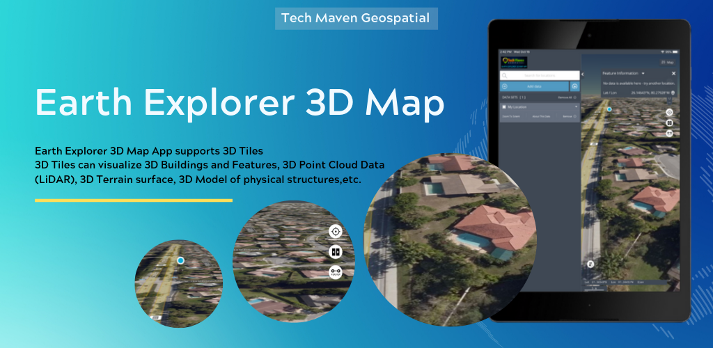
Earth Explorer is a 3D Globe with Augmented Reality (Control View with your device’s sensors GPS/GNSS, Accelerometer, Gyroscope, Compass, other).
Users can load local vector data to the map.Supported formats are:
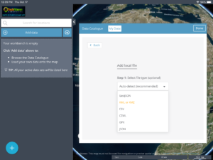
- GeoJSON,
- KML/KMZ,
- GPX,
- CZML,
- CSV – Comma Separated Value Text file – with Latitude and Longitude or with known column/field names like state, zipcode,country and other regional mapping fields
- JSON Catalog files – data layers defined in a JSON file.
Users can load online mapping services:
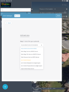
- ESRI Dynamic REST Mapping Services (MapServer, FeatureServer,ImageServer)
- OGC Mapping Services (WMS, WFS, WCS, WMTS)
- Raster Tile Servers – XYZ URL
- Vector Tile Server – XYZ URL
If users have Vector Data in other formats, they can upload to our server and have it converted and sent back to app/map as GeoJSON.
Features:
- Measure Linear and Area
- Search and Geocode
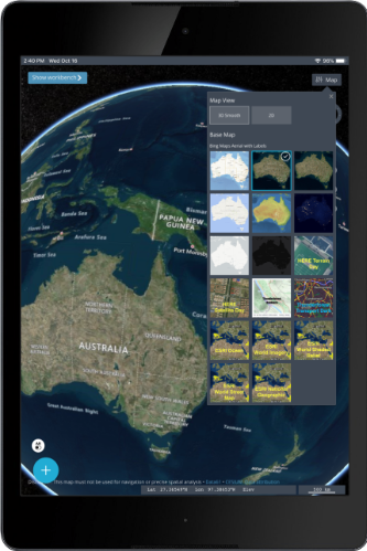
- Raster Tile Basemap Picker – uses BING
- Maps, Open Street Map, CartoDB
- Basemaps, Stamen Basemaps, ESRI Basemaps
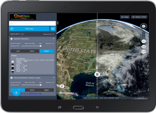
- Split/Map Swipe to compare layers
- Switch map between 3D Terrain, 2D or 3D Smooth
- Geolocation show your location on the map
- Tilt Map
- Rotate Map
- Table of Contents and Map Legend and ability to re-order data layers by dragging
- Displays Coordinates in Lat Long or UTM
- Drop Markers
- Copy Lat Long
- Ability to download tables from data loaded
- Zoom to Extent of Data
- Charting
- Timeslider on Spatialtemporal datasets
- Export/Print PNG/PDF of Map
- Share Link and Embed code
- View Metadata (data about data)
- Re-Order Table of Contents Items
- Search CKAN/CSW/SOCRATA OpenData
- Sites if Catalog file imported